









PlaceMaker
Quick 3D city design with detailed aerial photographs
With just two clicks, import high-resolution aerial photos, 3D buildings, roads, paths, trees, and water features using the PlaceMaker SketchUp Pro extension.
PlaceMaker Features
Google Earth 3D
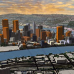
Import detailed 3D models directly from Google Earth into your SketchUp model, now without needing an API key. That also makes this feature available for users in the EU. Choose from four different levels of detail: from low for large surface areas and massing studies to high for detailed environments. New in v4: preview your Google Earth import before actually importing it, so you always know exactly what you’re getting.


System Requirements
- Host Software SketchUp 2024 – 2026
- Revit 2022 – 2027
- Operating System Any operating system compatible with SketchUp and Revit is also compatible with this extension.
- Internet Internet connection required
Since the release of version 4, PlaceMaker operates on a single cross-platform licence and can also be used directly in the browser. This allows you to download data suitable for import into applications such as Rhino, Blender, 3ds Max, Unreal Engine, and Lumion.
Pricing
PlaceMaker is available in the following licensing options (excl. 21% VAT).
- Ideal for students, small projects, and testing.
- Preview PlaceMaker data for free
- Purchase Credits to import all available data
- Use PlaceMaker with SketchUp, Revit, or on the Web
- Refill Credits to suit your needs
- License does not expire
- Use Credits for all data imports
- Perfect for commercial use
- Includes 1000 Credits
- Includes building bundle
- Free OpenstreetMap data
- Data at discounted credit rate
- Unlimited imports
- For active users
- Free OpenStreetMap Data
- Data at discounted credit rate
- Unlimited imports

Questions or more information?
If you’d like more information about PlaceMaker, please contact us.